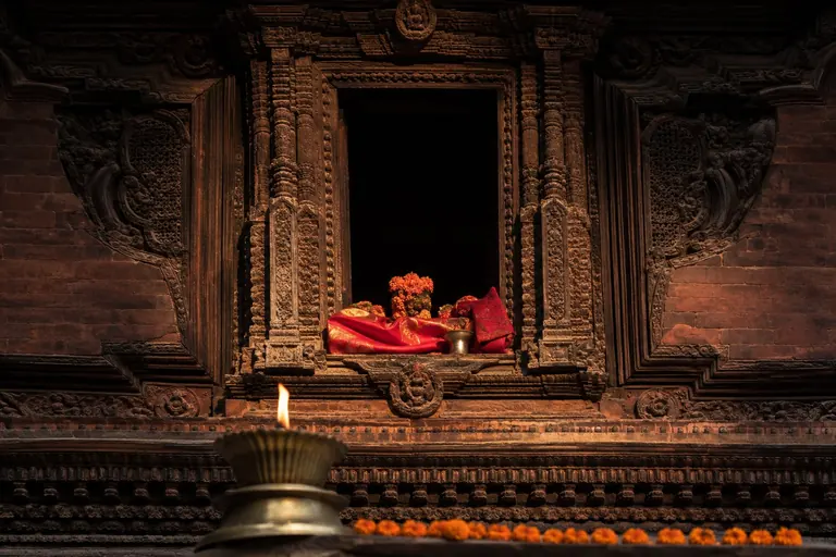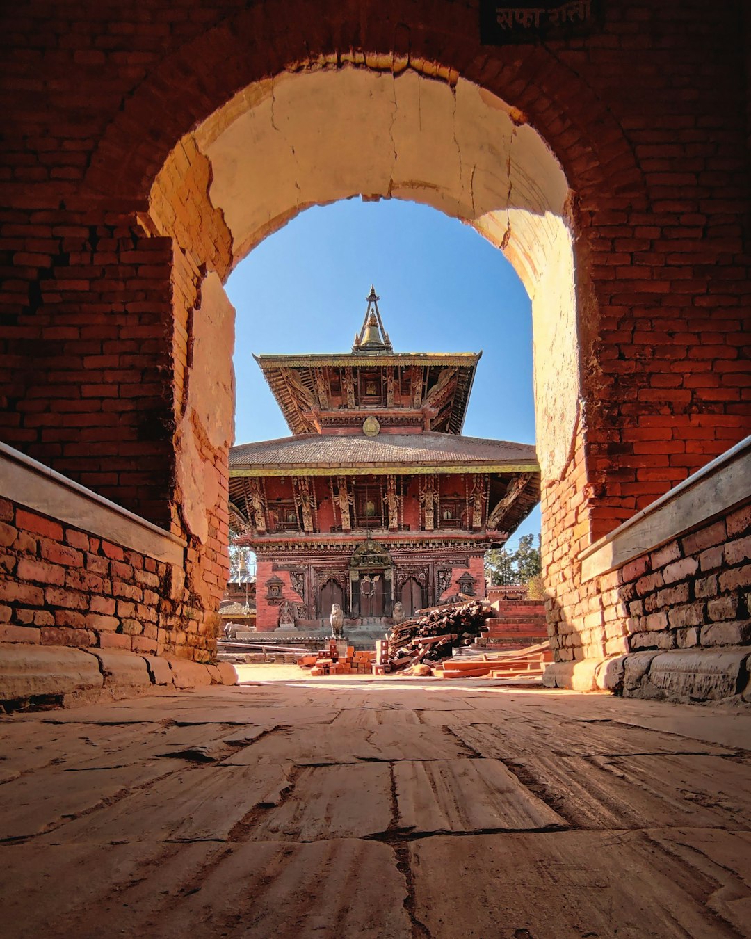
For a long time, ancient Nepal was often presented through dynasties, legends and sacred memory. Archaeology is making that picture more physical. At Lumbini and Tilaurakot, walls, roads, water systems, monasteries and settlement traces are allowing researchers to reconstruct how people actually lived, moved and organised space more than two thousand years ago.
The change matters because history becomes more precise when material evidence enters the conversation. A text can tell us that a place was important. Archaeology can show how large it was, how it was planned, what people built there, what they traded and how long settlement continued.
In Nepal’s southern plains, that process has been unfolding for years around the Greater Lumbini Area, where archaeologists, heritage authorities and international researchers have been examining a landscape tied to the early history of Buddhism and to the urban development of the ancient Tarai.
Table of Contents
Ancient Nepal as a landscape of connected sites
Lumbini is globally known as the birthplace of Siddhartha Gautama, the Buddha. But the archaeological story now extends far beyond the familiar sacred garden.
Archaeological work across the Greater Lumbini Area has treated the region as a connected cultural landscape rather than a collection of isolated monuments. Ancient societies did not experience temples, cities, villages, roads and agricultural land as separate entries on a heritage map. They formed one functioning world.
Excavations at Lumbini have revealed evidence of a structure dating to around the sixth century BCE. That places material activity at the site within the broad historical period associated with the Buddha’s lifetime. Archaeology cannot by itself prove every later tradition attached to a sacred place, but it can test whether settlement and ritual activity existed when historical memory says they did.
Tilaurakot and the Shape of an Early City
The most visually powerful evidence has emerged from Tilaurakot-Kapilavastu, the fortified settlement long associated with ancient Kapilavastu.
Geophysical surveys and excavations have mapped roads running in cardinal directions, fortification walls, structural remains and a monumental walled complex near the centre of the settlement. Researchers have also identified areas outside the city walls, showing that urban life did not stop at the fortification.
Water tanks dating to the Mauryan period, residential suburbs and major monastic remains have also been documented in the wider area. The archaeological sequence spans centuries, roughly from the first millennium BCE into the early centuries CE, showing that the region developed over a long period rather than appearing fully formed at one moment.
Why Roads Matter
Roads are some of the most revealing archaeological features because they tell us how people moved.
A city with planned routes is not simply a dense collection of houses. It reflects choices about access, administration, defence, trade and public movement. When roads align with gates and major structures, archaeologists can begin reconstructing how the settlement functioned as a system.
The evidence at Tilaurakot therefore contributes to a larger question: how urban was early Nepal’s Tarai?
The answer increasingly appears to be that parts of the region were deeply connected to the urbanising societies of the Gangetic plain. Nepal’s early history was not geographically sealed inside the boundaries of the modern state. People, objects, religious ideas and political systems moved across a much wider South Asian landscape.
Trade Leaves Quiet Evidence
Trade rarely survives as a signboard saying where merchants came from. Instead, archaeologists look for patterns: ceramics, coins, beads, production debris, imported materials and changes in settlement size.
When such evidence is studied together with roads and city planning, it becomes possible to ask how communities participated in regional exchange networks.
This is one reason the Tarai is so important to understanding ancient Nepal. The plains connect the Himalayan foothills with northern India. Long before modern borders, this geography created routes through which goods, pilgrims, officials and ideas could travel.
Religion Was Part of Daily Geography
The region’s monastic sites are equally important.
One of the most substantial finds near Tilaurakot is a large monastic complex at the Eastern Stupa area. Research beyond the fortified core has also examined suburbs and the wider hinterland.
This matters because religious history is sometimes told through famous monuments alone. Archaeology instead shows institutions occupying space beside ordinary settlement, agriculture and movement.
The Importance of What Archaeology Does Not Prove
New discoveries often produce exaggerated headlines. Ancient walls quickly become palaces. A settlement becomes a capital. A structure near a sacred site becomes direct proof of a famous historical person.
That is precisely where caution matters.
Archaeology is strongest when it narrows uncertainty rather than pretending to eliminate it. A sixth-century BCE structure at Lumbini is important because of its date and context. It should not be inflated into evidence for details the excavation cannot establish.
Ancient Nepal Was More Organised Than the Old Stereotype
One consequence of the new evidence is the weakening of an old stereotype: that early Nepalese history was mostly a story of remote communities separated by mountains until later political states emerged.
The Tarai evidence points toward a different reality. Organised settlements, planned streets, water infrastructure, fortifications and religious complexes show sophisticated social coordination at an early date.
That does not mean one archaeological site can stand for the whole territory of modern Nepal. Mountain communities, valleys and plains followed different historical trajectories. But it does mean the national story has to become more plural.
What the Kathmandu Valley Adds
The same principle applies further north. The Kathmandu Valley’s long settlement history, craft traditions and urban culture emerged from its own geography and networks.
Nepal Digest’s look at Old Kathmandu then and now shows how urban layers continue to shape the modern city, while the story of Nepal’s languages entering a new digital age illustrates how older cultural systems survive through adaptation rather than remaining frozen.
Why This Matters Now
Archaeological discovery is not only about adding older dates to textbooks. It changes decisions in the present.
When underground remains are mapped, road construction, tourism infrastructure and urban expansion have to account for them. When a site is understood as part of a wider landscape, conservation cannot stop at the boundary of one monument.
This is particularly important in rapidly developing areas of the Tarai, where roads, buildings and commercial activity can destroy archaeological evidence before it is documented.
A More Material History of Nepal
The strongest contribution of recent archaeological work is not one spectacular discovery. It is the accumulation of detail.
A road alignment. A defensive wall. A water tank. A monastery beyond the city. A settlement outside the fortification. A structure at Lumbini dating to the sixth century BCE.
Each fragment is limited. Together they begin to show systems.
That is how ancient Nepal is becoming easier to see: not as a neat story waiting beneath the soil, but as a landscape of cities, sacred places, movement and exchange whose complexity is only gradually being reconstructed.