
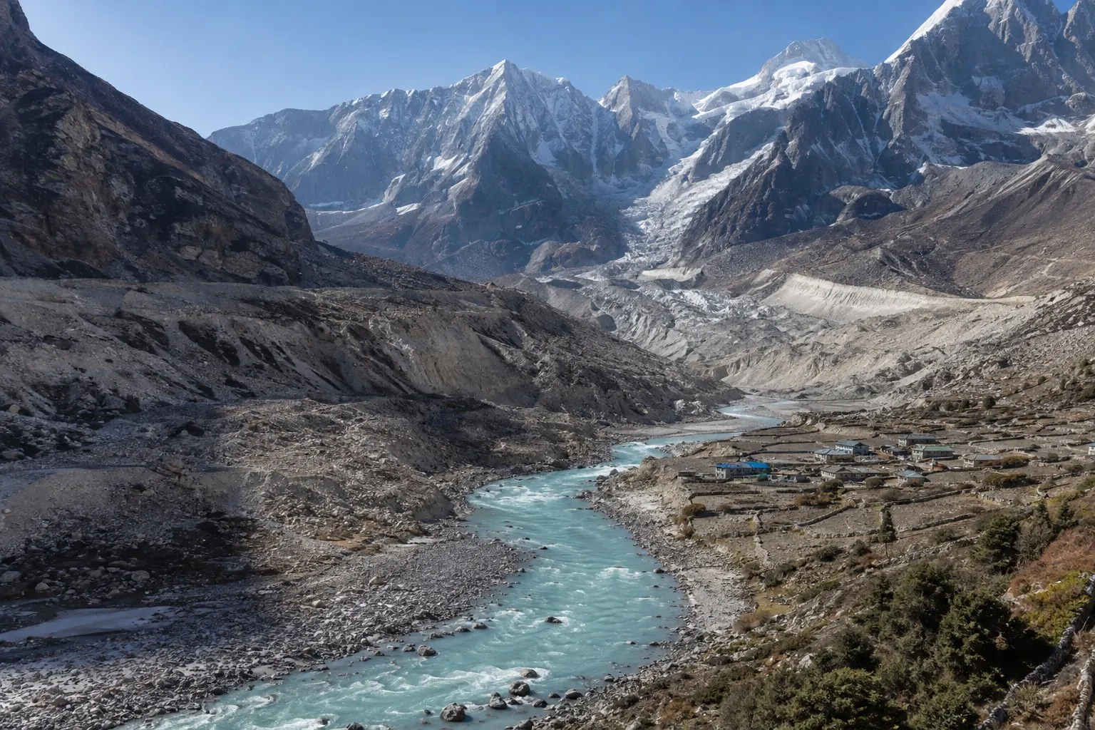
In Nepal, climate change is often pictured as a retreating glacier. The image is accurate, but incomplete. Warming in the Himalaya also changes snowfall, thaws frozen ground, alters the timing of river flow, expands some glacial lakes and intensifies the uncertainty faced by farmers, hydropower operators and communities living below steep slopes.
The country’s mountains and rivers form one connected system. What happens above 5,000 metres can influence a bridge, irrigation canal or drinking-water source far downstream. Understanding that chain is essential because Nepal cannot treat climate change as a remote environmental problem. It is already a question of infrastructure, food, energy, safety and public finance.
The evidence from the ice
Two major assessments released by the International Centre for Integrated Mountain Development in 2026 found that glacier loss across the Hindu Kush Himalaya has accelerated markedly. A regional analysis of 1990–2020 reported a 12 percent reduction in glacier area, with strong variation between subregions. A companion outlook drawing on five decades of field observation found that ice-loss rates have doubled since 2000 and that the large majority of observed years showed negative glacier mass balance.
These are regional findings, not a claim that every glacier in Nepal behaves identically. Elevation, slope, debris cover, precipitation and local climate all matter. But the direction is clear: the high mountain cryosphere—the system of glaciers, snow, ice and frozen ground—is losing stability under sustained warming.
Less ice does not simply mean less water tomorrow
The relationship between glaciers and rivers is more complicated than a slowly emptying reservoir. As ice melts faster, some catchments may initially receive more meltwater. Eventually, as glacier volume shrinks, that contribution declines. Scientists sometimes describe this turning point as “peak water.” Different basins reach it at different times.
Nepal’s major rivers are also strongly influenced by the summer monsoon. In central and eastern Himalayan basins, rainfall supplies a large share of annual flow, while snow and ice are especially important for seasonal timing and for water during dry periods. Climate change can therefore produce two apparently opposite problems: destructive water arriving at once, and insufficient water when communities need it most.
Snowfall and timing matter
Glaciers receive more attention, but seasonal snow is equally important. Snow stores winter precipitation and releases it gradually as temperatures rise. Warmer winters can change snow to rain, move the snowline higher and cause earlier melt. A river may still carry a similar annual volume while delivering it at a different time.
That shift affects irrigation, spring recharge and ecosystems adapted to seasonal cycles. A farmer planning a crop around familiar streamflow may face shortage even when total rainfall statistics appear normal. Water management must increasingly account for timing, not just annual averages.
Glacial lakes and cascading hazards
Retreating glaciers can leave depressions where meltwater collects. Some glacial lakes are held back by loose moraine, ice or unstable slopes. If a natural dam fails, a glacial lake outburst flood can send water and debris down a valley with little warning. Earthquakes, avalanches, rockfall and intense rain can interact with these lakes, creating compound risks.
The danger does not end when the first surge passes. A flood can erode riverbanks, destroy trails and roads, damage hydropower plants and deposit sediment far downstream. One event may isolate communities and disrupt trade or tourism for months. Monitoring the lake alone is not enough; authorities need valley-scale hazard maps, communication systems and evacuation plans understood by residents.
Thawing ground destabilises slopes
Permafrost is ground that remains frozen for long periods. At high elevations it can help bind fractured rock. Warming and thaw can reduce that stability, increasing the likelihood of rockfall and slope failure in some locations. Combined with intense rainfall, road cutting and seismic activity, this creates a difficult risk environment.
Nepal’s expanding road and hydropower networks must be designed for conditions that are changing. Historical averages are no longer enough. A bridge built only for yesterday’s flood pattern or a road aligned without future slope risk may become an expensive failure.
Hydropower faces both opportunity and exposure
Rivers are central to Nepal’s electricity ambitions. Hydropower can support low-carbon development and regional energy trade, but plants depend on reliable flow and resilient infrastructure. Changing runoff, sediment loads, extreme floods and landslides can reduce generation or damage intakes, tunnels and transmission corridors.
Climate-resilient hydropower begins before construction. It requires basin-level planning, conservative hazard assessment, sediment management and coordination between projects on the same river. Diversifying renewable energy with solar and storage can also reduce dependence on a single seasonal pattern.
The consequences reach farms and cities
Mountain springs supply drinking water and irrigation to thousands of settlements. Their behaviour depends on geology, land cover, rainfall and subsurface recharge, so not every drying spring has the same cause. Climate variability adds pressure to systems already affected by road construction, land-use change and population shifts.
Downstream, cities face a different version of the problem. Intense rainfall can overwhelm drainage and pollute water sources, while long dry periods strain supply. Agriculture must cope with uncertain planting seasons, heat stress, new pest patterns and flood damage. The greatest burden often falls on households with the least capacity to relocate, insure crops or rebuild.
Adaptation must be local and connected
There is no single Himalayan adaptation project. Priorities differ between a high-altitude village, a Tarai farming district and a hydropower corridor. Yet several principles apply across the country:
- Monitor continuously. Expand glacier, snow, river, rainfall, permafrost and glacial-lake observation, and make useful data available to local authorities.
- Design for compound hazards. Assess how rain, landslides, lake outbursts, earthquakes and infrastructure can interact.
- Protect watersheds. Forests, wetlands, floodplains and healthy soils can slow runoff and support recharge, though they cannot eliminate extreme risk.
- Strengthen early warning. A warning has value only when it reaches people in time, in a language they understand, with a rehearsed action attached.
- Plan at river-basin scale. Decisions upstream influence communities, ecosystems and projects downstream.
- Fund local capacity. Municipal engineers, schools, health posts and community groups are often the first to act during a disaster.
Nepal’s choices still matter
Nepal contributes only a small share of global greenhouse-gas emissions, yet it faces severe climate risk. That imbalance strengthens the country’s case for international climate finance and for much deeper emission cuts by major emitters. It does not make domestic choices irrelevant. Cleaner transport, efficient buildings, resilient energy, protected watersheds and safer construction can improve lives now while reducing future exposure.
The Himalaya is sometimes called Asia’s water tower, but the metaphor can suggest a stable tank. It is better understood as a dynamic system of ice, snow, rain, rock, forests, rivers and people. Climate change is altering the relationships within that system. Nepal’s task is to observe those changes closely, communicate them honestly and build for a future that will not behave exactly like the past.
For practical links to current weather and flood bulletins, see our monsoon planning guide.